Austin Flood Zone Map: Check Risk and Property Rules

An Austin flood zone map can show whether a home falls within a mapped floodplain, but it can’t tell the whole story of how water moves on a property. I’d start with a local floodplain resource, then compare the result with other available flood-risk information and check for drainage concerns the maps may not show.

City of Austin Flood Map Resources for an Address Search
For an Austin address, begin with an online flood map. Search the property address, then zoom in far enough to see where the parcel sits in relation to the mapped floodplain. The City says its online maps show the fully developed floodplain used to regulate development. That view is useful, but it isn’t a survey of the lot.
To make an address search more useful, check that the map has centered on the correct parcel. Look at the home’s location, not just the lot outline. A floodplain can cross one corner of a parcel while leaving the house outside it, and the distinction may matter for a planned addition or other work.
The City’s floodplain management information is another resource to consult alongside the map. The City notes that a creek or lake has a floodplain whether or not that area appears on a map. If you’re moving to the area, I include flood checks alongside the other property-by-property questions in my Austin relocation guide.
Flood Maps and What the Zone Labels Mean
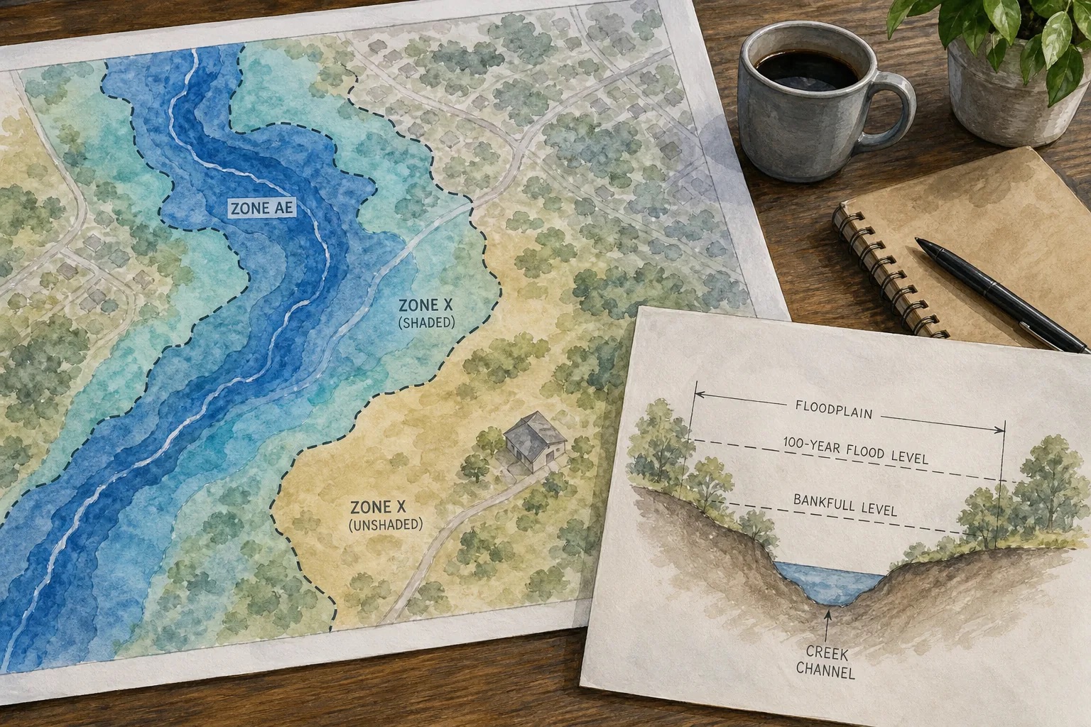
Flood maps help show areas with different levels of mapped flood risk. A 100-year floodplain does not mean flooding happens only once every hundred years. It means the mapped flood has a 1% chance of occurring in any given year. That chance can apply year after year.
A 500-year flood is a rare event. A 25-year event has a 4% annual chance. These labels describe probabilities, not a schedule. A property outside a mapped 100-year floodplain can still flood, and a property inside one may not have flooded during the owner’s time there.
Map labels can identify areas with different levels of flood risk. The City’s GIS layer also shows local floodplain categories and some shallow-water depth areas. A lower mapped risk is not a promise that water won’t reach the property.
Keep federal flood-risk maps separate from local development maps. While Austin updates local floodplain studies, the City says its regulatory floodplain is based on the current federal 500-year floodplain. The map used for a permit question may therefore show a different boundary than the one a lender uses for flood-insurance rules.
For a detailed property decision, I’d confirm which map and layer you’re viewing before drawing a conclusion. A map color alone doesn’t tell you the expected water depth at the house or how a future project would be reviewed.
How Flood-Zone Information Can Affect Insurance, Permits, and Value
A mapped flood zone can affect your insurance choices, a lender’s requirements, and the work you can do on a property. For some federally backed mortgages, flood insurance is required when a building is in a high-risk FEMA flood area. Ask your lender and insurance professional about the exact property and loan before you rely on a general map result.
For a clear look at how the map can connect to a mortgage or policy, I explain the basics in Austin flood insurance requirements. Insurance costs can vary by property and policy. Get a quote early, especially if you’re comparing homes with different flood designations.
A map check is a starting point, not a permit decision.
Flood status may affect how buyers assess a home, but it doesn’t set a sale price by itself. Buyers may weigh insurance, permitted use, and the location of the home on its lot. For sellers, clear records and early answers can help prevent confusion during due diligence. I encourage both sides to look at the actual building and planned use, not just the map shading.
When a property is near a mapped boundary, don’t assume a small map change has no effect. Ask the City which boundary applies to the work you’re considering, and ask your lender or insurer what they need to review.
Austin Map Updates, Local Flood Data, and Map-Change Questions
Austin’s flood maps change as the City learns more about rainfall, development, and drainage systems. New studies can expand a floodplain in one place and change its shape elsewhere.
That’s one reason an old map screenshot or a past seller’s statement shouldn’t be your final check. Start with an up-to-date flood map, then ask whether updated studies or a pending map revision could affect the property. The City’s website explains its ongoing remapping work and provides a path to its local tools.
People sometimes ask if they can challenge a flood-zone designation. A map change isn’t fixed simply because a homeowner disagrees with it. FEMA has formal map revision processes. If you believe a boundary is wrong, gather the property records and ask a qualified floodplain or engineering professional what evidence is needed.
Don’t confuse a formal map appeal with a guarantee of lower risk. A revised line changes the official map only when the proper review process supports it. Even then, drainage problems outside the mapped boundary may remain relevant to a buyer, owner, or builder.
Disclosures are another part of a purchase review. My guide to Texas property disclosure laws covers the records buyers should consider alongside their own map and property checks.
Austin-Area Floodplain Resources and Property-Level Follow-Up
Two City of Austin resources serve different needs. ATXFloodplains.com is a City web portal for the City of Austin. The Fully Developed Floodplain is a City GIS layer covering the City of Austin and Travis, Bastrop, and Hays counties.
The GIS layer can help people who need more than a quick address view, such as someone reviewing a parcel across county lines. It is a data layer, though, not a plain-language property report. If the map’s colors or labels aren’t clear, ask the relevant local office how to read them before using the result to make a permit or purchase decision.
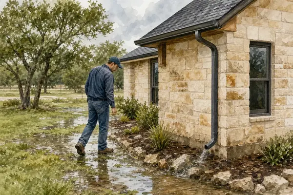
These maps don’t show every drainage concern. Water can collect in a low spot, flow down a driveway, or back up after a storm drain fills. Check the lot’s slope and nearby drainage paths. During a showing, look for signs of water entry and ask what the seller knows about past water issues. A home doesn’t need to sit beside a creek to have a drainage concern.
The City notes that permanent structures generally shouldn’t sit in drainage easements, though the exact terms in the property documents matter. Before planning a fence, pool, shed, or addition, review the plat and deed records and confirm requirements with the City. If you’re weighing land, I also recommend checking flood exposure as part of the broader Austin land due diligence process.
Robbie English, REALTOR, helps Austin-area buyers and sellers work through property questions without treating a map as the whole answer. I’d pair the official map with lender, insurance, City, and property-specific checks. You’re free to choose your own professionals for each part of that review.
Frequently Asked Questions
How do I check if an Austin address is in a flood zone?
Search the address in an official floodplain map, then confirm the correct parcel is selected. Check the floodplain layer and note whether the building itself appears within the mapped area. Compare that result with other official flood-risk information and contact the City if the boundary or map type affects a permit or purchase decision.
Does a 100-year floodplain mean flooding happens once every 100 years?
No. A 100-year floodplain describes an event with a 1% chance of occurring in any given year. It could happen in back-to-back years, or not during a long stretch. The label describes probability, not timing, and smaller storms can also cause flooding within the mapped area.
Can a property flood if it’s outside a FEMA flood zone?
Yes. A map doesn’t show every drainage issue or predict every storm’s effects on a specific lot. Water can collect in low areas or flow along streets and driveways. Check the property’s slope, drainage paths, and signs of past water entry along with the official maps.
Can I appeal a flood zone designation in Austin?
There are formal FEMA map revision processes, but a property owner needs supporting evidence for a proposed change. Ask the City which process applies, then speak with a qualified floodplain or engineering professional before planning an appeal.
Does being in a floodplain affect building permits?
It can. Austin reviews development in floodplains under local rules and federal program requirements. Remodels or repairs to an existing building may also require information about the work’s cost. Confirm the applicable boundary and permit rules with the City before you start design work or commit to a project.
Conclusion
Use the City map and FEMA information as a first check, then verify the building, drainage, and planned work with the right local professionals. If you’re considering an Austin-area property, I’m Robbie English, REALTOR, and I can help you identify which questions to take to the City, lender, or insurer before you move ahead.
Categories
- All Blogs (990)
- !!! (59)
- !x (621)
- Austin Real Estate (113)
- Bee Cave Real Estate (1)
- Building A Home (14)
- Buying A Home (152)
- Buying Land (1)
- Cedar Park Real Estate (58)
- Central Austin Real Estate (75)
- Down Payment Assistance Programs (1)
- Downsizing (4)
- Downtown Austin Real Estate (5)
- Dripping Springs Real Estate (62)
- East Austin Real Estate (3)
- Financing and Mortgage (24)
- first-time homebuying (110)
- Georgetown Real Estate (9)
- Hill Country Real Estate (1)
- HOA (3)
- Home Appraisals (13)
- Home For Rent (1)
- Home Inspections (9)
- Home Pricing (6)
- Home Staging (1)
- Home Values (12)
- Home Warranties (1)
- Homeownership (1)
- Homes For Rent (1)
- Homes For Sale (147)
- Hutto Real Estate (5)
- Insurance (1)
- Investing (6)
- Investment Properties (4)
- Lakeway Real Estate (33)
- Leander Real Estate (59)
- LGBT+ Real Estate (8)
- Luxury Homes For Sale (5)
- Luxury Real Estate (19)
- Market Conditions (17)
- Moving to Austin (2)
- Moving to Texas (4)
- Negotiations (3)
- Neighborhoods (8)
- Northwest Austin Real Estate (94)
- Off Market Listings (7)
- Pflugerville Real Estate (11)
- Private Listings (2)
- Property Management (42)
- Property Tax (5)
- Real Estate (18)
- Reddit Question Answered (80)
- redwrite (63)
- Relocation (2)
- Renting (6)
- Representation (34)
- Round Rock Real Estate (59)
- Selling Your Home (63)
- South Austin Real Estate (1)
- Westlake Real Estate (3)
Recent Posts